


Springvale Twp. Voting District, Isanti County, Minnesota
About
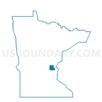
Outline

Summary
| Unique Area Identifier | 602563 |
| Name | Springvale Twp. Voting District |
| County | Isanti County |
| State | Minnesota |
| Area (square miles) | 35.33 |
| Land Area (square miles) | 34.37 |
| Water Area (square miles) | 0.96 |
| % of Land Area | 97.29 |
| % of Water Area | 2.71 |
| Latitude of the Internal Point | 45.59523250 |
| Longtitude of the Internal Point | -93.33264510 |
Maps


Graphs
Select a template below for downloading or customizing gragh for Springvale Twp. Voting District, Isanti County, Minnesota


Neighbors
Neighoring Voting District (by Name) Neighboring Voting District on the Map
- Bradford Twp. Voting District, Isanti County, MN
- Cambridge Twp. Voting District, Isanti County, MN
- Cambridge West P-1, Isanti County, MN
- Dalbo Twp. Voting District, Isanti County, MN
- Maple Ridge Twp. Voting District, Isanti County, MN
- Spencer Brook Twp. Voting District, Isanti County, MN
- Stanchfield Twp. Voting District, Isanti County, MN
- Wyanett Twp. Voting District, Isanti County, MN
Top 10 Neighboring County Subdivision (by Population) Neighboring County Subdivision on the Map
- Cambridge city, Isanti County, MN (8,111)
- Bradford township, Isanti County, MN (3,380)
- Cambridge township, Isanti County, MN (2,379)
- Wyanett township, Isanti County, MN (1,729)
- Spencer Brook township, Isanti County, MN (1,589)
- Springvale township, Isanti County, MN (1,447)
- Stanchfield township, Isanti County, MN (1,209)
- Maple Ridge township, Isanti County, MN (761)
- Dalbo township, Isanti County, MN (743)
Top 10 Neighboring Place (by Population) Neighboring Place on the Map
Top 10 Neighboring Unified School District (by Population) Neighboring Unified School District on the Map
Top 10 Neighboring State Legislative District Lower Chamber (by Population) Neighboring State Legislative District Lower Chamber on the Map
Top 10 Neighboring State Legislative District Upper Chamber (by Population) Neighboring State Legislative District Upper Chamber on the Map
Top 10 Neighboring 111th Congressional District (by Population) Neighboring 111th Congressional District on the Map
Top 10 Neighboring Census Tract (by Population) Neighboring Census Tract on the Map
- Census Tract 1303.01, Isanti County, MN (8,442)
- Census Tract 1305.01, Isanti County, MN (5,323)
- Census Tract 1306, Isanti County, MN (3,897)
- Census Tract 1301, Isanti County, MN (3,513)
- Census Tract 1303.02, Isanti County, MN (2,829)